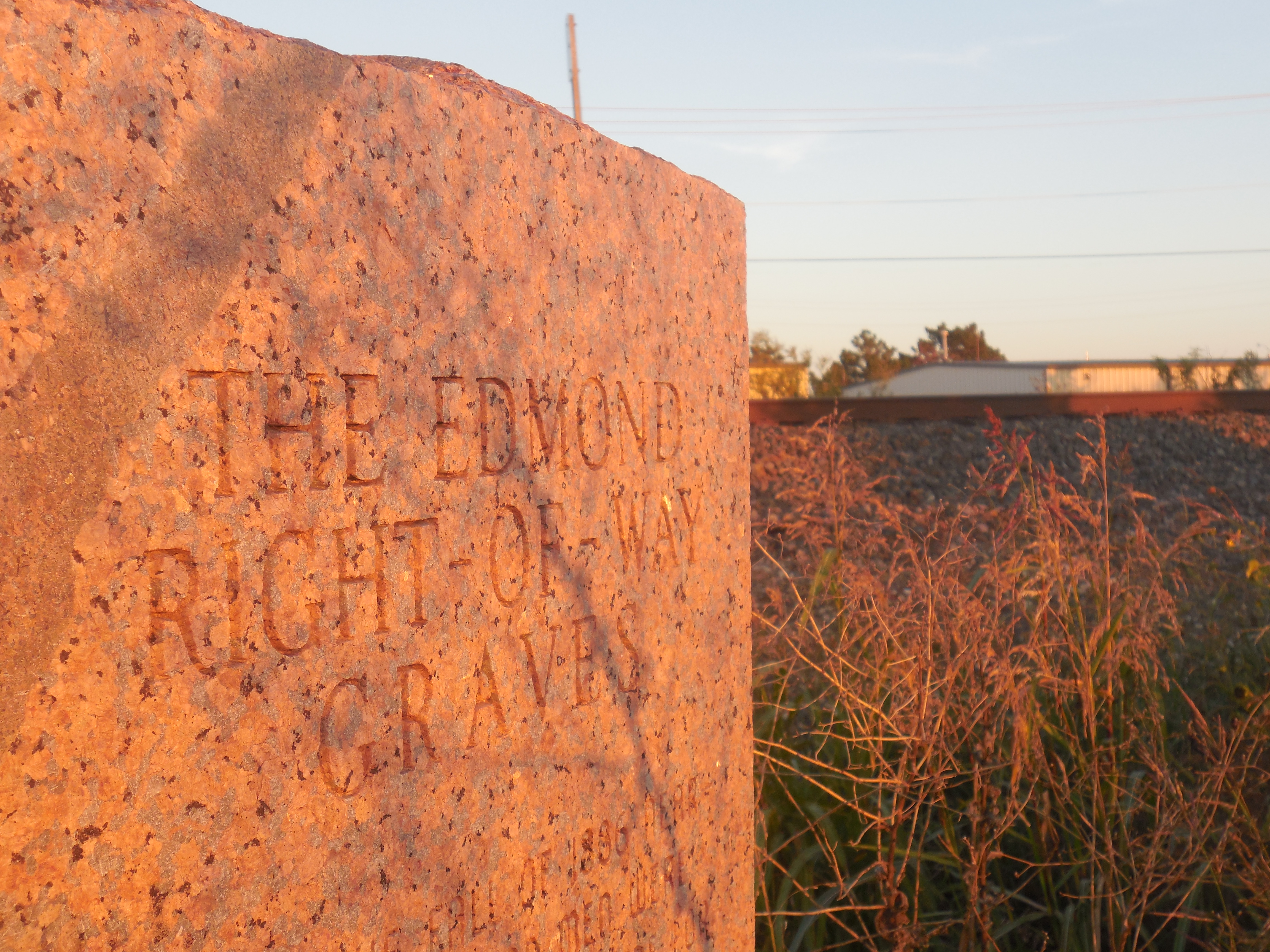
Come and travel Oklahoma with me.

Archive for the ‘Oklahoma history’ Category

RIP Crossroads Mall

Bre at the fountain at Crossroads mall 1974

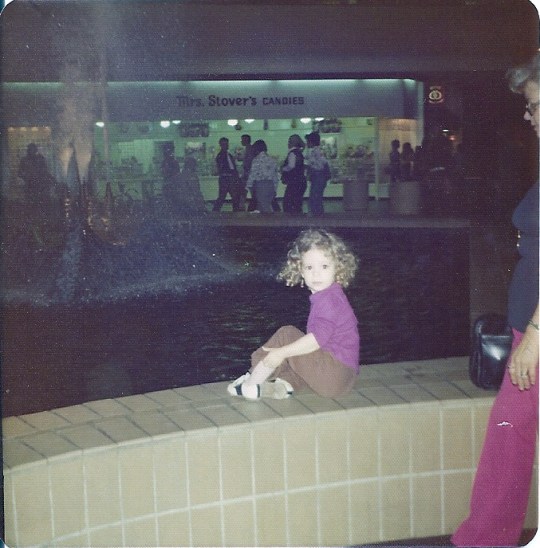
The little Fat Okie with her Granny at Crossroads Mall Spring 1974


On October 31st, 2017, what was one of the greatest malls in the country closed for what might very well be the last time.  Crossroads Mall came into existence in 1973 and was the place to shop for 25 years.  While older generations of Oklahomans recall the shopping experience of downtown Oklahoma City in the 1940’s-1960’s, it’s my generation that will speak fondly of Crossroads.  In the ’70’s and ’80’s, that’s where you hung out, whether you were really shopping or just needed some place to go instead of school.

I have very fond memories of Crossroads.  It opened in February 1974, I was just a baby.  We lived in Norman and it was the closest mall at the time.  We were there shopping all the time, especially the holidays.  I can still remember playing in the clothes racks at Montgomery Wards while my parents shopped for Christmas presents for the extended family.  We always started at the Wards entrance, I think my parents had a credit card they could use there, so it was first on the trip.  I remember being 8 and finding a cute purple dress at Wards, I needed it for some school presentation.  My parents were nice enough to buy it for me.  Later in the early 1990’s I found another cute purple dress there, my dad got it for me as a Christmas gift.  At least I still have that one.

After Wards, you went into the main mall.  I always started upstairs.  The first store you would come to was the pet store.  Don’t remember the name but I loved going in there to look at all the cute kittens and puppies.  Now I know that those cute animals most likely came from a puppy mill but then everything was still innocent and you just didn’t think about things like that.  After that you had Eastern Treasures, where you could always find cool stuff that was way more expensive than my budget would allow.  A little further down was Spencer’s with all of their lava lamps, black light posters, and lightning balls.  That store just seemed magical to me with all of their silly stuff.  There was no real food court, so we would stop at the McDonald’s for lunch.  For some reason I thought it was cool that you had to go up another half level to order, it was like the counter was on a stage.  After we were done eating, we would pass Frederick’s of Hollywood.  That was another store that held a fascination with me, especially after I was a teenager in the ’80’s.  All of that cute, lacy clothes that you saw on MTV was there in that store.  It was so cool.  Eventually we would get to the other end of the mall, JC Penny’s.  On one trip in the ’90’s I found these cute stuffed “honkers” from Sesame Street in the kids section.  I was just walking through and had to have them, still do.

Downstairs we would then go and into the Hobby Shop.  Another store that was just too much fun.  You never knew what you could find in there- model cars, model trains, collectibles of all sorts.  Next door was the Le Mans arcade.  I was always up for a few rounds of skeeball but if my dad was with us, you might as well be prepared to stay a while.  He would play Donkey Kong and Pac-Man until he ran out of quarters.  Once we got back to the middle, we would sit and look at the fountain.  I can still see those blue tiles in my head.  After making a wish and throwing a penny in, I would then ask to run up and then back down the ramp.  Seems silly now but back then it was fun.  Eventually we made it back to Wards and out to the parking lot.   We always went in the downstairs entrance and to the south of the doors there was a hill that led to the upstairs parking lot.  My dad would carry me to the top of the hill, then with his hands under my arms, would start to run down.  By the time we hit the parking lot, my feet were off the ground and it was like I was flying.

I remember in the 1980’s going on many shopping trips with my Granny.  She would want to “work out the plastic”, those trips were always good for a new sweater.  I know I’m not the only kid in the metro who spent a school day ditching at Crossroads.  I’m sure all of the schools would have benefitted from having a paid lookout, then many of us would have been enjoying some quality time in the office explaining how the mall cured us of what was ailing us that day.

The Nineties saw a change in the mall, the ownership at the time thought it was a good idea to remove the ramp and fountain.  Replaced with an elevator and carousel, some of the magic was lost.  In the late 90’s, a series of shootings gave the mall a bad reputation that it could never overcome.  The situation was worsened by road construction on I-35 and I-240, construction that is still going on today.  Stores started to close eventually becoming a dead mall.  A group tried to bring it back but with no luck.  Now the mall is up for sale with rumors of it becoming a school or office space (there is a school in the old Wards section currently).

Just makes me sad to drive by and remember all the fun of going to the mall.  Also makes me sad to think of all the younger generations who will never know the fun of ditching and hanging out at the mall.  So RIP Crossroads, we may not be able to waste our days inside your doors any longer but we’ll remember the good days that you did give us.

Bre at Crossroads mall 1974

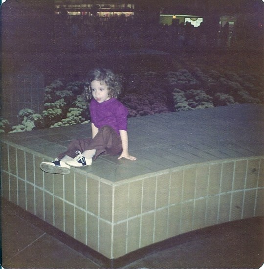
Little Fat Okie at Crossroads Mall Spring 1974

Arrow from the Past

Arrow

UPDATE:  As of November 9, 2018 the current Space Needle that took the place of this arrow is being torn down.  It was badly damaged after a flood in June 2010.  Some believe that the fairgrounds administration never intended to fix the space needle and wanted to demolish it.  No I’m not happy to see more of Oklahoma’s history being destroyed.  Hopefully something will be saved from the space needle.

I spend a lot of time driving the back roads of Oklahoma and while out in the country southwest of Yukon, I found something that really intrigued me- a big arrow.  Just sitting in this field, rusting away.  Odd, definitely not something you normally see so I had to learn more about this strange sight.  Turns out it is quite important to the history of Oklahoma and the state fair.

In 1957, the state of Oklahoma held its Semi-Centennial Exposition at the new State Fair Park.  The fairgrounds had only recently been moved from its location around NE 10th and Douglas to the home we know now at NW 10th and May.  This celebration, held June 14th- July 7th, was a big deal.  Not only did the fairgrounds stay open 24 hours a day, but well- known performers of the time such as Patti Page and Mickey Rooney made appearances.  The Today show from NBC hosted by Dave Garroway broadcast live so the whole country could see the excitement of the crowds.  As a center piece to this great celebration was the Arrows to Atoms tower.  A 200 foot tall red and white arrow with an atom just below the tip, I have been told that you could see it for miles even at night when the point was illuminated from inside making a red glow.  This tower had been dedicated at few months before on April 22, 1957 and represented the progress Oklahoma had made in 50 years.

This tower stayed in the middle of the fairgrounds until 1967 when it was deemed structurally unsound and was removed.  It was replaced the next year by the landmark we all know now as the Space Needle.  What many do not know is that after removal, the arrow was cut down to about 80 feet and placed on land owned by an employee of the Utility Tower Company (who had originally built it) near SW 59th and Frisco Roads.  Even though the property (called Odd Acres by some locals) has changed hands a few times, that arrow still sits on the side of the road.  It’s no longer red and white and the atom is long gone (even though I’ve heard the rumor that it was placed on top of the current space needle, I can’t confirm this), it provides a great nesting place for birds.  Just a piece of Oklahoma history, sitting in plain sight and unfortunately rotting away.

Arrow Point

Originally red, the arrowhead is 15 feet tall and lit from the inside.

Arrow bottom

The tail section was 26 feet tall.  You can still just make out the red on the outside panels with white down the middle.


Kingfisher in Lights- Back Again

Kingfisher christmas lights 6

UPDATE-  Great news for those of us who loved the lights in Kingfisher, they are back on!  A group of Kingfisher residents have gotten together to restore this tradition, now under the name Kingfisher Winter Nights.  I haven’t been yet to see how many of the old displays are still there but hope to make it soon.  Hopefully they have enough visitors to keep the lights on for years to come.

From the time I was a little girl, one of our family Christmas traditions was driving around neighborhoods looking at the Christmas decorations people had put on display.  We did this every year, I remember going around Brookhaven in Norman, when almost every house was lit up.  We were some of the first to drive around Ski Island, before the crowds got too big that the residents shut it down.  Now that I’m older I love the light parks that different cities in the metro have for everyone to drive through.  I’ve been going to Midwest City since the first year the lights were turned on, we’ve gone to Yukon so many times they should at least name a light bulb after me, Chickasha is a long drive but a special treat but one that I really liked the best was the one that was the least popular, Kingfisher in Lights.

Not many knew about the Christmas display that the city put on every year in the park since 1996.  Everything was east of downtown right off of Highway 33 at the Kingfisher Park.  You could park your car, walk to the train station and for a dollar get a ticket to ride the small train through the displays.  It was almost always too cold and the lines really long but it was worth the 20 minute ride.  Most of the time you would get a seat in the enclosed cars but once we got to sit in the coal tender.  Yeah, it was cold but fun.  After the train ride, we would then get in the car and idle through the display, seeing everything from a different angle.  From the car you could talk to the fire-breathing dragon or watch the angels climb into the air.  You could get a better view of the baseball game being played in lights or just count the candy canes along the trails.  There was a cute display of a frog eating a fly and another with firemen putting out a fire.  Sometimes Santa would be out there, handing out candy to all the kids.  After you drove through you could then go back on another road to the the west side of the park and walk across the one hundred year old suspension foot bridge.  The bridge was lit with over 1000 white Christmas lights and you could see the creek very clearly from the deck.  One year while walking across, I saw something swimming in the water twenty feet below, it was a very large beaver that was making his home in the branches piled up along the small concrete dam.  I had seen lots of beavers dead along the side of the road but never out in the water, doing beaver stuff.

Kingfisher christmas lights 2

The fire-breathing dragon, 2010.  (Sorry, didn’t have a good camera at the time.)

Sadly this has all come to an end- in 2014 the lights were canceled because of road construction on Highway 33.  You just couldn’t get to the park.  I could understand that, I was disappointed but was hoping it would be up again this year.  Unfortunately, the display now been closed down for good.  Many of the residents of Kingfisher just didn’t have the time to volunteer and put the lights up.  So now it’s just a memory just as the one year Guthrie had a display (east of Cottonwood Creek, best I can remember is late 1990’s or very early 2000’s) and Duncan’s display (also in the late 1990’s or early 2000’s).  Maybe someday the town will realize they miss it and bring it back.

Christmas lights on bridge in Kingfisher 2001

Uncle John’s Creek bridge in lights, 2001.

Washita Battlefield National Historic Site

Washita Battlefield 20

Many don’t realize that we have three National Parks in the state of Oklahoma.  All three are beautiful places to visit and each unique.  Unfortunately two are places where great tragedy and loss have occurred.  The Washita Battlefield National Historic Site in one of the oldest and most tragic.  So on a nice fall day a few weeks ago we made a trip to the far western part of the state to visit this historic location.

Near the current town of Cheyenne, Chief Black Kettle and his tribe of Southern Cheyenne had made winter camp on the Washita River in early November 1868.  There had been an uneasy peace with the Cheyenne after the Medicine Lodge Treaty signed in October 1867.  In the summer afterward, that peace was broken when groups of Cheyenne, along with other tribes, started attacking white settlers in Colorado, Texas, and Kansas.  This marked the tribes as “hostile” according to the United States Army.

Washita Battlefield 11

Along the banks of the Washita River, 2015.

With winter coming, many of the tribes settled along the banks of the Washita River (or Lodgepole River, as named by the tribes because of the numerous trees) Black Kettle’s village of around 250 was the western most settlement.  The Army had been stationed near Fort Cobb in western Indian Territory.  General Philip Sheridan decided on a “winter campaign” against the tribes to try and get them to surrender.  So in late November 1868, the general ordered Colonel George Custer and the 7th U.S. Cavalry to attack Black Kettle’s village.  Early on the morning of November 27, 1868 Custer’s forces converged on the village and in no time had taken control.  Black Kettle and his wife were amongst the first killed.  The exact death toll isn’t known but it is believed that around 50 Cheyenne were killed along with 21 soldiers.  To keep any of the Cheyenne from escaping, Custer also ordered over 700 horses to be slaughtered and dumped in a ravine.  He then took the surviving women and children as prisoners and burned he camp.

Washita Battlefield 5

Site of Black Kettle’s Southern Cheyenne 1868 winter camp, 2015.

So with this kind of history it’s obviously a sad place to visit.  The location was put on the National Register of Historic Places in 1966 and in 2007 the state built a new visitor center and museum.  After you walk through the museum, you can go out to the site and walk the 1.5 mile marked trail.  It wasn’t a long walk but it can give you the creeps especially near the reported location of the horse grave.  You can see where the army scouted out the village and get an idea of what the land would have looked like around the time of the massacre.  This is a place to take older kids to help them learn about Oklahoma history and since it is part of the park service they do offer a Junior Ranger badge for completing a booklet geared toward different ages.  I would recommend going but make sure you have some walking shoes on.

Hours: Visitor Center open 7 days a week 8am-5pm except for Thanksgiving, Christmas and January 1st.  Overlook and trail open from dawn to dusk daily.

sunflower

Sunflower on the trail to Black Kettle’s village on the Washita River, 2015.

Museum of the Western Prairie

Museum of the Western Prairie in Altus

Windmill at the Museum of the Western Prairie, Altus, OK, 2015.

A few months ago I went on a road trip to the southwestern part of the state.  It was August and 104 degrees out but I didn’t care, there were places I wanted to go and see.  I went looking for the Cross S Ranch Headquarters south of Olustee and couldn’t find it.  Eventually later that day I ended up in Altus and had time to visit the Museum of the Western Prairie.

It’s back off the road in a park, a low building with dirt up around it to make it look like an old dugout home from the late 1800’s.  I had been there before many years ago and saw a picture of downtown Eldorado, Oklahoma, that showed the Farley blacksmith shop.  This was the shop that my great-great grandfather Jeff Farley ran in the 1890’s.  So on this visit I wanted to find that picture again and show it to Mae, just to emphasize our family history here in Oklahoma.

The building had been remodeled a few years ago, so things had changed and the picture was no longer on display, but there were still plenty of other exhibits to show her just how our family lived in that time period.  They had the usual covered wagon and other household items from the time of settlement in Jackson County.  But one of the more interesting items on display was a console from the Atlas missile silos that surrounded Altus and it’s air force base from 1962-1965.

Control board for Atlas rocket in Altus

There is more outside in the courtyard that showcases the history of southwestern Oklahoma.  Windmill, farm equipment, a buggy, and the Criswell half-dugout.  Davis and Sarah Criswell built the half-dugout in old Greer County (now part of Jackson County) around 1900.  This dugout is a great example of what a family home looked like out on the western prairie.  But also in this courtyard is where I finally found the Cross S Ranch Headquarters building.  It’s still in the process of being restored (for more info read my previous post about the history of this building).

The museum was started in 1966 when the Western Trail Historical Society started raising money to build a museum in Altus.  The building was completed in 1970 and officially became a Oklahoma Historical Society field museum in 1973.  The Criswell half-dugout was placed there in 1976 and the Cross S Ranch Headquarters was rebuilt there in 2009.

So if you’re a history nerd like me or just want to get an idea of what life was like on the western prairie around the turn of the century, stop and check this museum out.  Takes about an hour to see everything.  Older kids might like it but younger kids would probably be bored, not a lot of kid type stuff to do.  I do hope the next time I visit they have that Eldorado picture back out.

Address: 1100 Memorial Drive, Altus, OK.  From Main Street (or State Highway 6), turn east on Falcon Road, then go less than a quarter of a mile to Memorial Drive.  The museum sits at the end of the road.

Hours: Tuesday- Saturday 10am-5pm.

Museum of the Western Prairie in Altus 3

Haunted Fort Washita

Bre's Late October 2015 159

The west and south barracks at Fort Washita, OK, 2015.

Hey, it’s the week of Halloween so let’s have some fun and talk about one of the most haunted places in Oklahoma- Fort Washita.  I had heard the stories for years, ghosts wandering the property, strange experiences, weird feelings.  So back in 2002, we decided to visit (this was before children) and yeah, the place definitely had a creepy vibe.  We never actually saw a ghost or had anything unexplained happen to us, but we both felt like someone was watching us the whole time we were there.  After that visit we have talked about the place just giving us the creeps and that we never wanted to go back.  So like morons, we went back a couple of weeks ago, taking Mae with us this time just to see if a pre-teen girl could get the spirits worked up.

The fort was placed on top of a hill not far from where the Washita River joins the Red River in 1842.  It was built by the military to protect the Chickasaws and Choctaws from other Indian tribes.  The original fort was spread out over an area of seven square miles and contained almost 100 buildings constructed from locally quarried limestone.  By 1861, the fort was abandoned and taken over by confederate troops as a supply post.  Although no battles were ever fought here, near the end of the war the confederates burned the buildings and abandoned the post.  The United States military turned over the property in 1870 to the Chickasaws who then allotted the land to the Colbert family.  The state of Oklahoma took over ownership of the land in 1962, this is when the historical society added the front entrance and started work on the reconstruction of the south barracks.  In 1965 the fort was placed on the National Register of Historic Places.

Bre's Late October 2015 170

The south and west barracks in background with remains of the commissary in front, Fort Washita, OK, 2015.

As I said earlier, my first trip was in 2002, you can walk or drive around the ruins.  The south barracks weren’t open to tour but you could go in the rebuilt chaplains’ quarters and the D.H. Cooper cabin.  On this recent visit we discovered that the rebuilt south barracks had burned down in 2010 but everything else was the same as before.  I didn’t get that same strange feeling I had the first time and neither did my husband, even though he told me later at one point near the old post road he heard “thundering hooves”.  I didn’t hear or see anything and neither did Mae even though she kept her guard up.  I was hoping that at least one ghost would come and scare her.  It’s an interesting place to visit and if you see a ghost or hear something unusual don’t be surprised.  The fort is in far southern Oklahoma near Durant and Tishomingo off state highway 199.

south barracks Fort Washita 2002 2

South barracks at Fort Washita before they burned in 2010, Fort Washita, OK, 2002.

Fort Washita

Map of Fort Washita, 2015.

Olustee Public Library and Park

Olustee library

If you ever find your self having to go down Oklahoma Highway 6 in the far southwestern part of the state, you will go through the tiny town of Olustee.  As you enter the town you will go right past the library and park and except for a small sign you might not know it’s on the National Register of Historic Places.

The park itself is interesting enough- a full block with old style playground equipment, you know, the stuff most people my age played on before the safety nazis took over.  You have the big old metal slide, teeter-totter, and swings.  There is an old Frisco caboose sitting in the northwest corner of the park and a sidewalk trail that leads around the whole park.  The park came into existence in 1920 when the New State Womens Club developed the property to help improve the quality of life in Olustee.  The Womens Club had been formed in 1907 to help establish a library and park in the small town.

Throughout the 1920’s members of the club took care of the park by planting trees and in 1925 the club turned over ownership of the property to the town of Olustee. Plans were made in 1921 for a small building to be placed in the middle of the park to be used as a library.  But the depression slowed the development of that plan.  In 1936, two members of the Womens Club met with representatives from the Works Progress Administration to see if they could get help with the library project.  It was approved quickly and work started on the building in April 1936 with the stone quarried from a local farm.  Since 1907 there had been temporary locations for a library in Olustee and by August 1936 a permanent building was done and filled with books donated not only by the Womens club but other residents of the community.  The New State Womens Club maintained not only the library but the park from the opening until the 1990’s.  At that point the library closed, with all the books and town records still inside.  The library and park were placed on the National Register in March of 2008.

I would love to go in the building, just to see the records and journals left behind.  The park is just a normal park.  I tried to get Mae to go down the slide, but it was 106 degrees out and she had a dress on, so it wasn’t happening.  It’s an interesting stop if you happen to be in that area.

Olustee library 6

Olustee Public Library, Olustee, Oklahoma, 2015.

Olustee park

Olustee Park, Olustee, Oklahoma, 2015.

The Edmond Right-Of-Way Graves

Bre's mid Oct 2015 018

So everyone knows that the intersection of Broadway and 33rd Street in Edmond is bad.  Poor design, too much traffic, and lights that never seem to change.  I hate that intersection and try to avoid it at all costs but when I do get stuck there, I wonder if the traffic troubles in the area are a ghostly legacy of the two men buried near there.  What?  What do you mean?  There isn’t a cemetery near there, can’t be any graves.  Well that is where you are wrong, they aren’t easy to get to but yes, there are two graves just northwest of the intersection along the railroad tracks.

Let’s go back to 1886, surveyors for the Southern Kansas Railway (later part of the Santa Fe Railway) picked a location at mile marker 103 (it means one hundred and three miles south of Arkansas City, Kansas) for a coaling station on the rail line.  A few months later in September the crews came through to “scrape” the land and prepare the grade for the rail line to be laid.  On September 17th, two members of this crew, Frank Mosier and Willie Davis were killed in a fight and then buried along the rail line just a few miles south of marker 103.  What was the fight about?  Did they kill each other?  Was there really a fight?  Did they die of something else, disease or heat exhaustion maybe?  Many historians have tried to uncover the truth but what really happened to these two men is lost in time.  All we really know is that the two men were buried along the railroad right of way, side by side.

For many years the railroad tended to the graves.  There were two markers for the men, Willie Davis has a small iron cross and Frank Mosier had a stone with his name carved into it.  But as time went on, the graves had become overgrown with weeds and grass.  There have been some people who tried to take care of the graves but with the development of Edmond it was hard to keep the location clean.  At some point vandals broke Mosier’s stone and scattered the pieces in the field.  Some Edmond residents put up a wooden cross and someone has put gravel over the graves.  In 1979 the Oklahoma Historical Society put a granite marker at the site and embedded Mosier’s stone into it.  The Santa Fe railway still owns the site but has not done a good job tending to it.

This is not an easy place to find.  There is really no way to the graves.  You can try to park along the businesses that backup to the rail line but there is a very big ditch to get through in order to get to the tracks.  The other option is the one I took, park at the business on 33rd Street, then walk the rails around the curve to the site.  I will warn you- this is not safe and possibly illegal.  It is a blind curve and if you aren’t paying attention the train can come around very quickly.  I went to the site on a slow rail traffic afternoon, so I was lucky but it was still scary and any little noise sent me down the rail grade to the ditch.  I’m also not going to say the site is haunted, but I just wanted to get out of there, felt very uncomfortable.

So every time you are around the intersection of Broadway and 33rd Street in Edmond, look to the northwest at the railroad track and think about the two men who lost their lives and now reside permanently in that location.  Maybe they are “controlling” the traffic flow at that intersection.

Bre's mid Oct 2015 014

The grave marker of Willie Davis, Edmond, Ok, 2015.

Bre's mid Oct 2015 021

The granite marker with Frank Mosier’s headstone embedded next to the grave site, Edmond, OK, 2015.

The (Used to Be) Great State Fair of Oklahoma

OKC from space needle 3

View from the Space Tower in 2006, at the time I didn’t realize how much of this history would be gone.  You can see the Grandstand in blue on the left, the old Travel and Transportation Building and Clock Tower in the middle, and the B-52 on the right.

Every fall in Oklahoma means that not only has football season started but that it will be fair time in Oklahoma City.  I used to love going to the fair, it was like going to a special playground once a year with lights and food.  As I got older I loved going to see those old landmarks that brought back great memories, riding the monorail and the space needle.  Now almost everything is gone; the monorail, the grandstands, several buildings, the waterfall in the flower building, and even though it’s still there, the space tower sits empty and broken.

Let’s start at the beginning, the first “fair” in Oklahoma City was in 1889 a few months after the land run.  A small group of residents, with the names of Charles Jones, Ed Overholser, H. G. Trosper, and D. F. Stiles, organized the first Oklahoma Territorial Fair.  They bought some land on the northeast corner of Santa Fe and Reno Avenues, then built some buildings, such as a racetrack.  This fair was successful for a few years until the economy started to fail and the population dropped, so it was discontinued in 1894.

Every once in a while for the next few years there would be various street fairs but nothing like an official fair with a designated time and location.  This changed in January of 1907 when Jones along with Charles Colcord organized a state fair association.  A new location was chosen for the fairgrounds at the southeast corner of Eastern Avenue and NE 10th Street.  The first fair was held on October 5th of 1907, just a month before statehood.  There were of course the usual farming and agriculture exhibits, carnival attractions, but the biggest draw was the horse racing on a half-mile track.  Even though the racing stopped in 1913 when the state legislature banned it, there was still plenty to do such as watch car races, ride hot air balloons, or enjoy an air show.  Of course there were lean times during the great depression but the fair still went on.  There was talk of moving the fairgrounds, the location was too small, not enough parking, and at times problems with flooding.

OKC from space needle

Another view from the Space Tower in 2006, on the left near the bottom of the pic is the old Goodholm Mansion and behind that the Flowers and Garden Building.

These issues were finally addressed in 1951 when the city acquired land between Reno Avenue and NW 10th Street west of May Avenue, which had been the old Sandlot Baseball Park.  The new location hosted its first fair on September 25, 1954.  This is when the grandstands were built with an oval racing track and just south, a drag strip which hosted the National Championship Drag Races in 1957-1958.   Many other buildings were built around this same time such as the 4-H and FFA buildings, the Made in Oklahoma Building, Women’s and General Exhibits Building (now known as Modern Living and Creative Arts Building), Appliance Building (now known as the Kitchen’s of America or Centennial Building), and some of the agriculture barns.  In 1964 the monorail makes its first trip around the fairgrounds and a year later the State Fair Arena (also known now as Jim Norick Arena or “the big house”).  1968 is the first trip into the air on the Arrows to Atoms Space Tower with the Travel and Transportation building to follow the next year after being built around Santa Fe engine #643.    In 1977 the Clock Tower is built from an old oil derrick, in 1978, the Flowers and Gardens Building opens with its waterfall over the doors.  The Goodholm Mansion is moved to the grounds in 1979 after being saved from the wrecking ball.  In 1984 is when we got the big “balloon top” building called the International Trade Center, leaving us all to go in through doors that helped regulate the pressure inside and make our ears pop.

Fair Train 2

Santa Fe steam engine #643 sitting in the courtyard of the Travel and Transportation Building in 2004.  It was built in 1879, given to Oklahoma City and placed at the fairgrounds in the 1950’s.  It is currently being cleaned by volunteers at the Oklahoma Railway Museum.

So many of these landmarks are now gone- the B-52 is gone, the big slide is as well, the log plaza has disappeared.  Some have been saved and moved, the planes are all over the country, the Goodholm Mansion is out near Choctaw, and just this summer the Oklahoma Railway Museum got the old steam train.  Even the cow barns smell fresh instead of like cow poo mixed with hay.  You can still get a good corn dog or cotton candy, but so many of the foods have just gotten wilder just to see what you can deep fry next.  So I still pay to go to the fair, it’s just not a fun as it once was, back when it really was a Great State Fair.

dr pepper sign 2

Even this cool old Dr Pepper sign on the back of the Made in Oklahoma Building is gone, 2011.

Cross S Ranch Headquarters

Cross S Ranch Headquarters 3

Cross S Ranch Headquarters, Museum of the Western Prairie, Altus, OK, 2015.

While I was bored over the summer, I found a listing of all the locations in Oklahoma on the National Register of Historic Places.  I then started getting curious, do some of these places still exist?  So just using Google Maps Satellite Images I would put in the address or coordinates to see if the building was still standing or if something had happened.  The majority of the time everything was the same but there are some places that are gone.  Why are they gone?  What happened to them?  Fire, tornado, moved?  So I have set out to find these historic places and give everyone an update.

One of the first places that caught my interest was the Cross S Ranch Headquarters in Jackson County.  It should have been on a country road West of Elmer and South of Olustee but no matter how many times I looked, I could not find a building on this piece of farm land.   So off to southwestern Oklahoma I went, at the beginning of August in 100 degree heat (I’ve never been accused of being smart).  After a short drive through Elmer, trust me it’s a small town, I ended up close to where the ranch headquarters should be.  I was close because the road didn’t look too good and after the rains they had in May and June, I didn’t know what I would find further out.  But I was on the location of Cross S Ranch.

Cross S Ranch

Actual location of the Cross S Ranch, the headquarters building would have been in this field.  Looking to the west from County Road N199, Olustee, OK, 2015.

The Cross S Ranch was started on this open prairie in what was then Greer County, Texas by the Eddleman Brothers.  L.Z., Ira and Lee Eddleman started grazing cattle in this very area in 1880.  This was in a time that the cattle could roam free without fences or borders.  In what many believe was 1891, the brothers built the two-story headquarters building out of limestone.  It was not only the headquarters for the ranch but a home for L.Z. Eddleman.  Around 1893 the brothers moved out of cattle ranching and solely into the breeding and breaking of horses.  This continued until the 1900’s when the brothers eventually moved away from the Cross S ranch, onto other ranches they owned not only in Oklahoma but around the country.  L.Z. Eddleman did still own the Cross S and used it from time to time at this point, mostly for farming.  The headquarters building was still used as a home until the 1930’s and afterward may still have been used by members of the family for various reasons, such as family reunions.  By the 1970’s the ranch was no longer owned by the Eddleman family and the headquarters had been abandoned.

In 2006 the ranch headquarters was included on the National Register of Historic Places.  But the building was in horrible shape, the roof was falling in, the second story floors had rotted away, and the stone blocks were collapsing.  That is when the Museum of the Western Prairie in Altus moved in, raising money to have the headquarters building moved.  In 2009, they started dismantling the stones and moving everything to Altus, where the building was then reconstructed.  This is why I couldn’t find it, the building had been moved, it is now rebuilt in the courtyard next to the museum.  It is nice the way it’s been refurbished but I think I would have liked to have seen it restored on the prairie where it had been.

If you want to go look for it, you can find it at the Museum for the Western Prairie in Altus, 1100 Memorial Drive.   The original location of the ranch can be found 5 miles south of Olustee west of the intersection of County Roads N199 and E1750.

inside Cross S Ranch Headquarters 2

Inside the Cross S Ranch Headquarters.  The first floor has been restored, the second floor should be done in a few years.  Museum of the Western Prairie, Altus, OK, 2015.

Cross S Ranch Headquarters marker

Stone marker with the Cross S brand stamped on it.  Museum of the Western Prairie, Altus, OK, 2015.